


产品描述
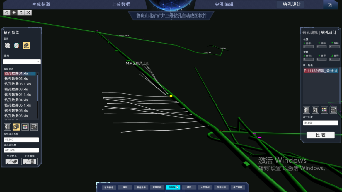
By establishing a designated mine 3D model, the drilling trajectory can be automatically/manually mapped on the mine 3D model. At the same time, functions such as drilling layout display, drilling length statistics, drilling timeline display, and comparison between actual drilling layout and designed drilling layout can be achieved.
| Drill list display | Search function |
| Drilling parameter display | Upload and download functions |
| Add or remove drilling functions | Read and process external drilling data |
| Production drilling model function | Edit drilling point function |
| Edit drilling color function | Display drilling footage statistics |
| Modify drilling name function |
Interface display
Official Account

Chongqing Baian Technology Co., Ltd
Company Address: 22-5, No. 11, Panxi Seventh Branch Road, Shimahe Street, Jiangbei District, Chongqing
Production address: 3rd floor, Building 2, Gangcheng Science and Technology Innovation Park, Haier Road, Jiangbei District, Chongqing
Tel:+86-4000672018 +86-023-67630927
E_mail:cqbakj@yeah.net